Mount Rainier - Disappointment Cleaver
The Disappointment Cleaver-Ingraham Glacier Direct (DC) route is the most popular summit route on Mount Rainier
Mount Rainier - Disappointment Cleaver
The Disappointment Cleaver-Ingraham Glacier Direct (DC) route is the most popular summit route on Mount Rainier
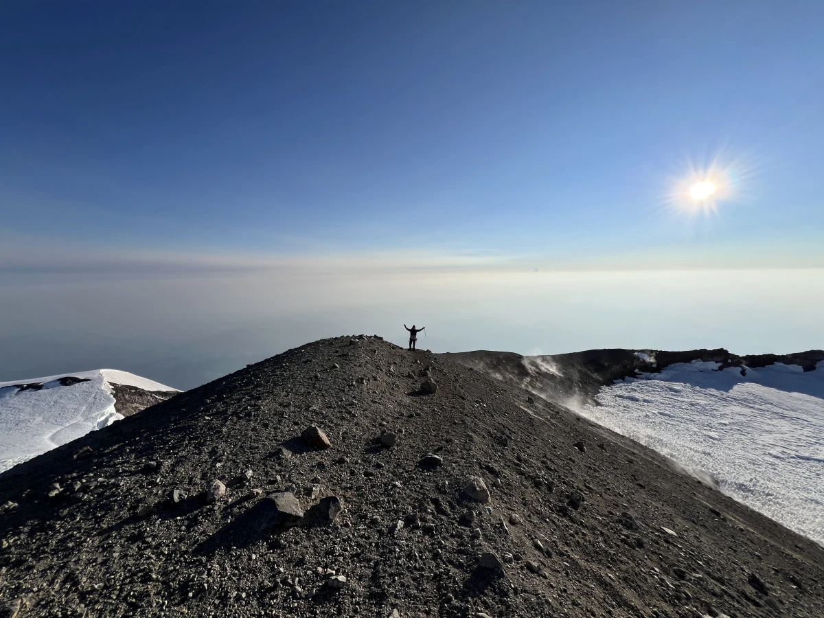
Rainier summit!!
View on Strava Date: Aug 9, 2024 at 6:10 AM Moving time: 6h 20m
Paradise
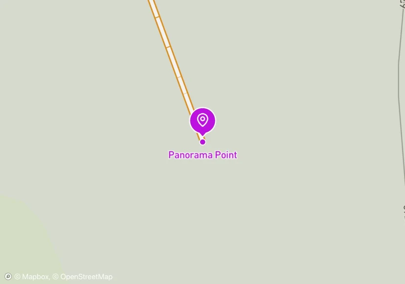
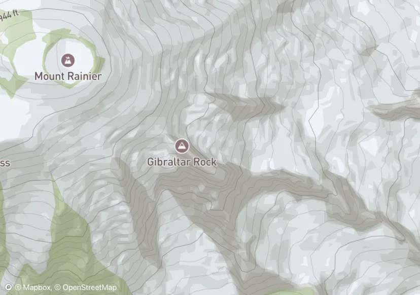
Panorama Point
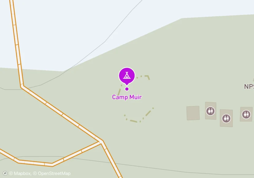
Camp Muir
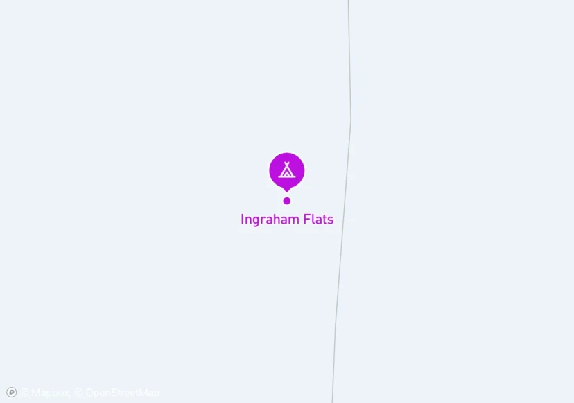
Ingraham Flats
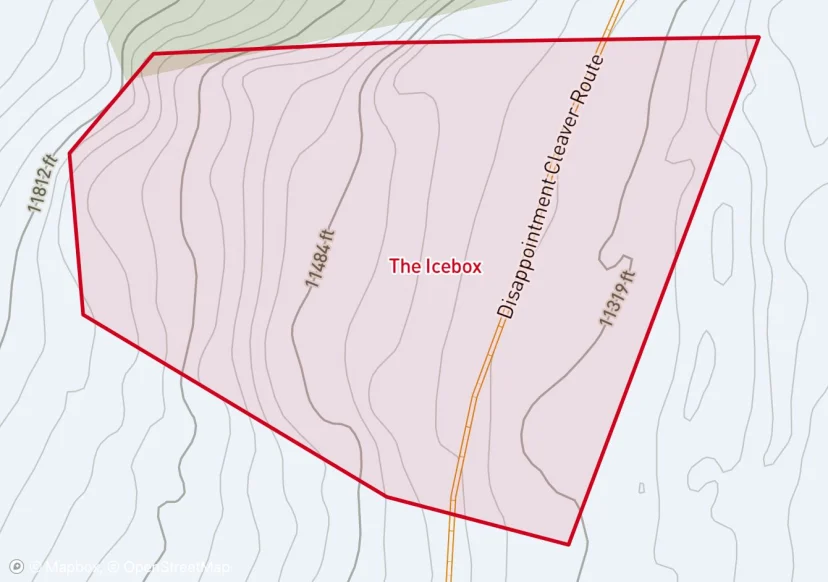
The Icebox
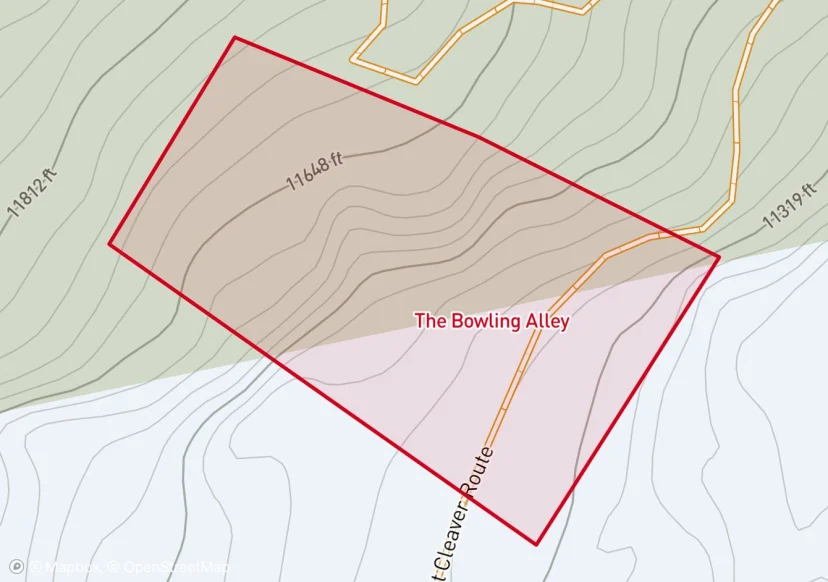
The Bowling Alley
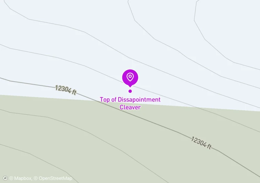
Top of Dissapointment Cleaver
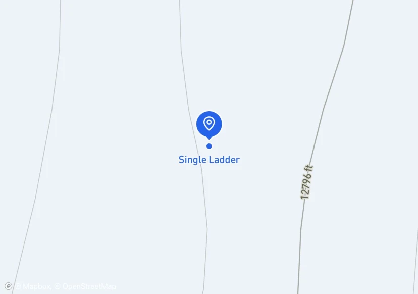
Single Ladder
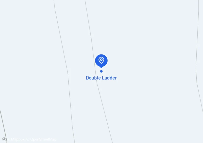
Double Ladder
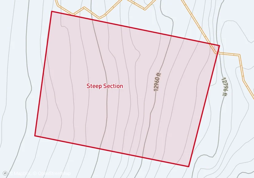
Steep Section
Proficiency with cramponing and increasing team security is required in the section between 12.8k-13.2k.
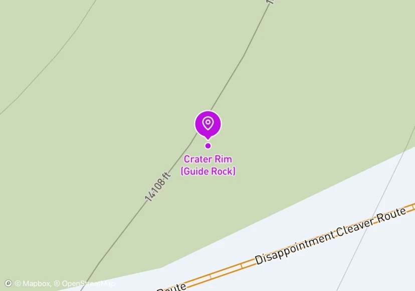
Crater Rim (Guide Rock)
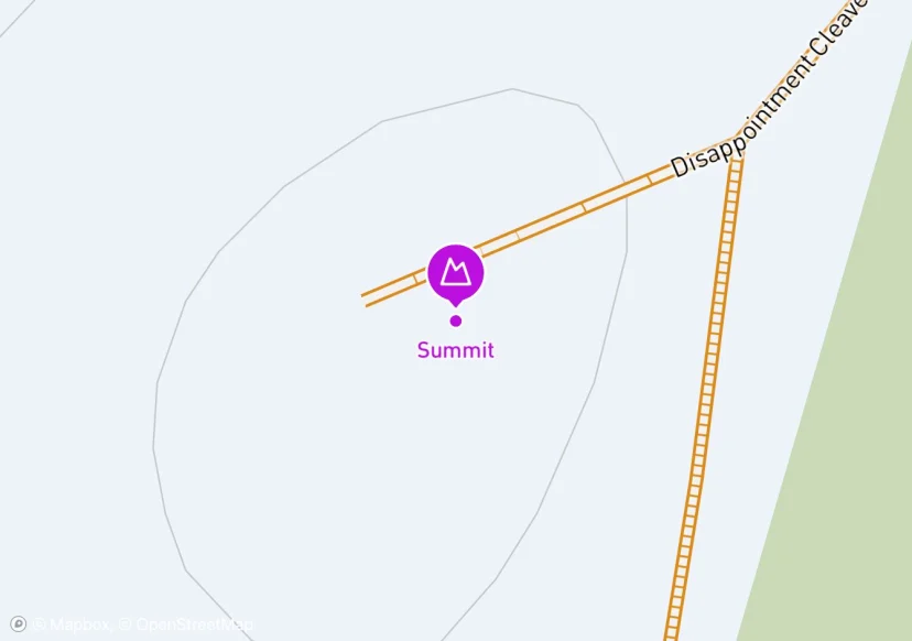
Summit
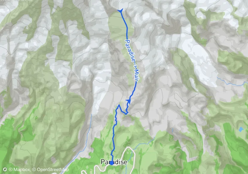
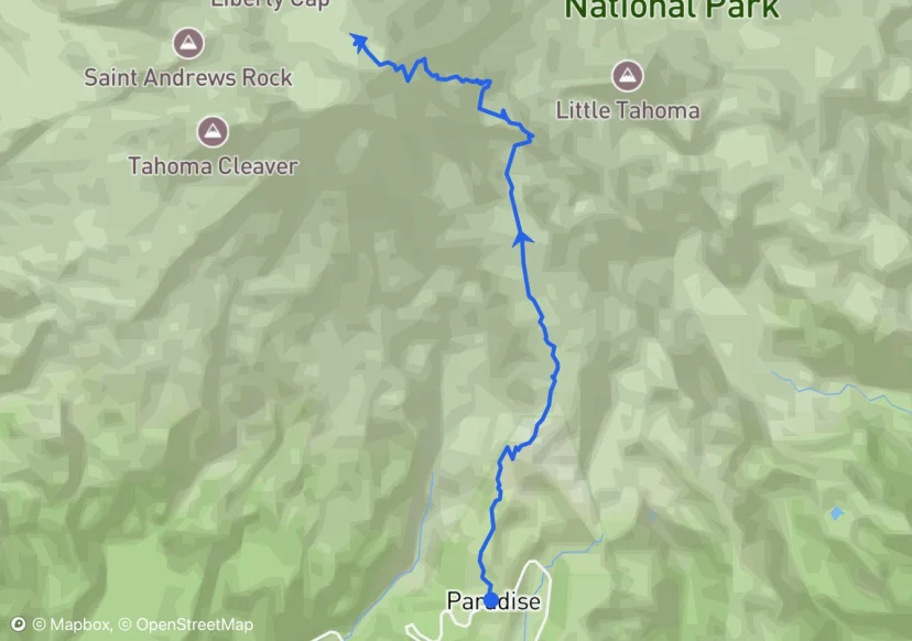
Paradise -> Muir
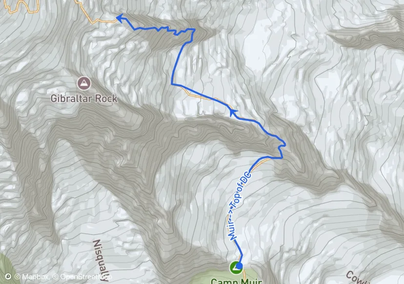
Muir -> Top of DC
Camp Muir to Ingraham Flats Camp Short rope to navigate switchbacks ~1000’ gain/~1.5 hours (we should be able to get here in an hour, but giving us a little buffer as we get comfortable with the climb) Ingraham Flats Camp to Icebox/Bowling Alley Ok for about 800’ and then enter danger zone at about ~12,000’ Don’t stop in either Icebox or Bowling Alley sections and keep total exposure time to ~10 minutes ~800’ gain/~1 hour Icebox/Bowling Alley to the Top of DC Short rope to avoid knocking shit down Route finding gets harder but guides leave markers Little crevasse risk Top of DC is at about 12,300’ and this is a good place to do a check in before things get more technical ~300’ gain/~30 min
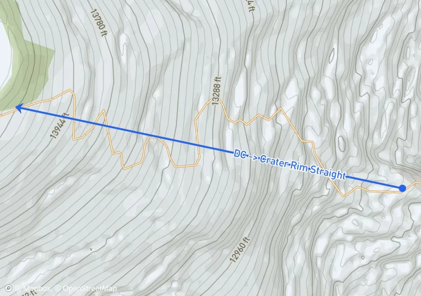
DC -> Crater Rim Straight
The current route is in the same location as our route update on 07/28. The route is standard from Camp Muir to the top of the Cleaver, currently with no adjuncts. The route then goes direct from the top of the cleaver toward the summit. This takes climbers through a steep section of snow that ends in a single vertical ladder at 12.8k. There is a handline and pickets for running protection. As always, inspect these pieces of "fixed gear" before using them. Expect this section to change rapidly, especially with this prolonged period of high freezing levels. Below shows images of this section. Topping out from the ladder, the route weaves through crevasses for a few hundred feet before approaching the traverse under a large crack at 13.2k that leads to the double ladder. This traverse is exposed to another section of overhead hazard, with a 'tidal wave' feature of sagging snow that hangs above in places. The route then ascends the double ladder that has fixed pro above, and a hand-line along the ladder. It continues through a steeper section that levels out around 13.5k, and continues to the summit. Top of DC to Crater Rim (Guide Rock) Long rope Lots of crevasses Latest reports say route now goes straight up through the crater towards the summit (steep until 13,500’) Single vertical ladder at 12,800’ (there is a handline and pickets for running protection) Traverse along large crack at 13,200’ (some overhead hazard from snow “tidal wave”); double ladder with fixed pro above and handline (need 30 feet of rope between each person to cross) Enter Crater at about 14,100’ ~1800’ gain/~3.5 hours Guide Rock to Summit Ok to unrope Traverse through crater to true summit (Columbia Crest) on NW side (will pass Register Rock - must add our names!!) Ice caves under the crater that are often covered by thin snow bridges, walk carefully ~300’ gain/20 minutes Recommended that we spend no longer than an hour in the crater, including time it takes to walk from Guide Rock to summit and back
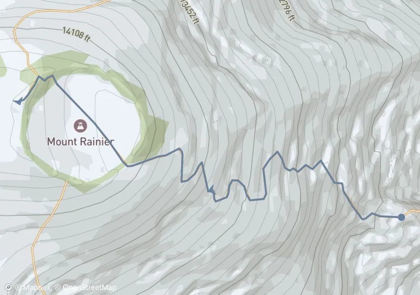
Standard DC -> Summit
This is not the current route
Porter - Morning Hike
Porter - Lunch Hike
Your next adventure starts here
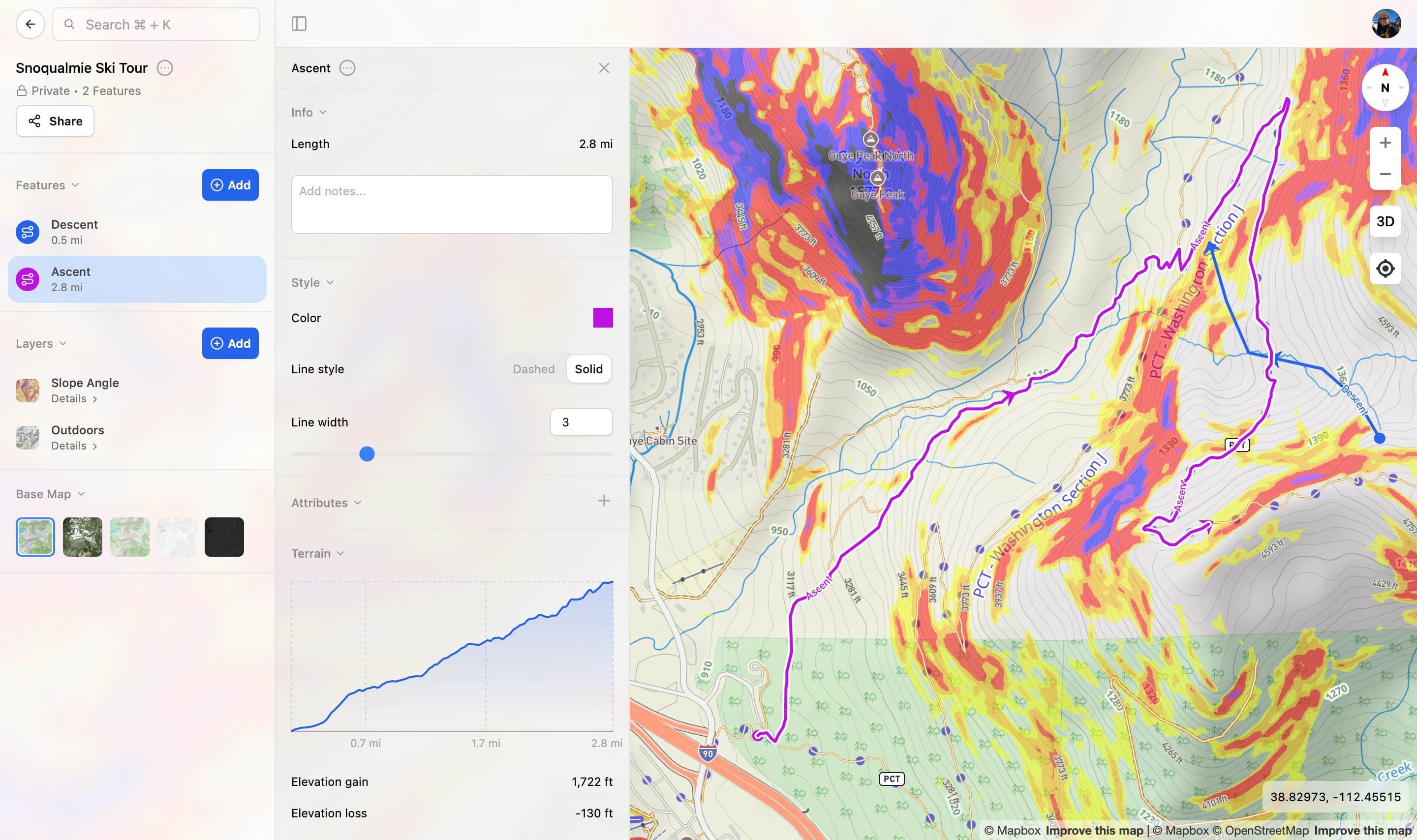
Create your own maps with custom routes, waypoints, and layers. Then share with your friends to kick off your adventure planning.